Bishop via Kearsarge Pass to Crabtree Ranger Station (21.5 PCT Miles + 8.6 Bonus Miles)

On the road to the Onion Valley trailhead
Bishop made an ideal spot for our third zero of the hike, and the weather was beautiful. The nights were crisp and cool and the daytime highs were in the high 60's to low 70's, warmer than anything we've seen in weeks. We both needed warmer gloves for the cold conditions of this late season, and were also hoping to replace some socks and underwear. This town of 3500 people has not one or two, but three outdoor/gear shops and we were easily able to find what we wanted. The town is also compact, so it is easily walkable and we got all of our errands done before Cynthia arrived in the afternoon. We were a little surprised at how expensive food and lodging were, given the small size and remote location, but chalked it up to Bishop's place as a mecca for all things mountain, and the number of visitors it must see annually. On the other hand, for a town with such a huge population of visiting mountain enthusiasts from big expensive cities we expected a bit more in the way of interesting food options. We weren't that impressed with the selection of eateries but did manage tofind a few good spots. Black Sheep Roasters made the best coffee, had vegetarian breakfast burritos, and had a small but good-looking food menu posted. Pupfish Cafe in the back of Spellbinder Books had great salads and sandwiches, and although we didn't try one, their liege waffles looked & smelled terrific. Upper Crust Pizza made good pies and basic yet fresh and tasty salads.

Ready to hit the trail again, and glad it's not snowing at Onion Valley this time around
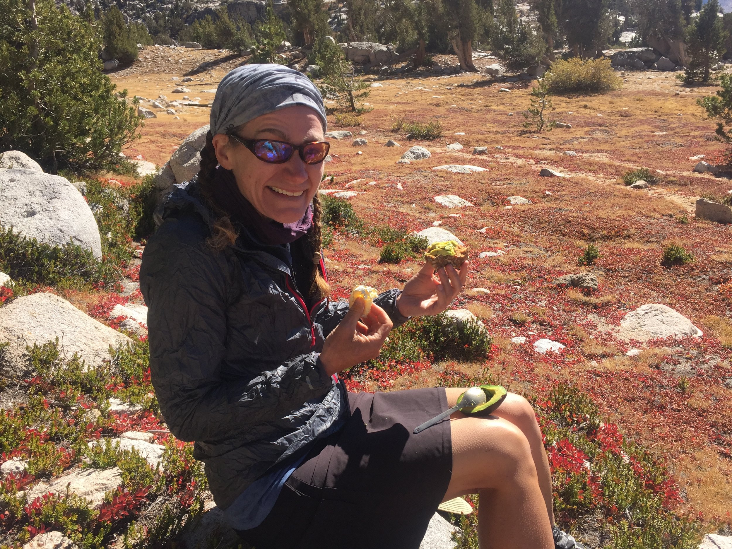
Cynthia came bearing loads of fresh food and plenty of treats. She brought a half-loaf of Pain de Mie from MH Bread & Butter, our favorite bread from our favorite local bakery! Since she also brought avocados, we promptly took over the toasters in the Travelodge lobby to make avocado toast while we caught up with her. We sorted out our resupply food and maps, and decided how long we planned to take for the final stretch of the Sierra Nevada. It's amazing how much there is to do on a zero day, and how there is really no time to just sit and relax. We settled on 5 & 1/2 days to Kennedy Meadows South, where Cynthia will meet us again and may even camp out for the night to try out this thru-hiker life. This schedule allows for a slightly later trailhead start out of Onion Valley, provides a full day for a round-trip to the Mt. Whitney summit, and otherwise requires moderate daily mileage. With this relatively short stretch between resupplies we were able to fit some extra treats into the bear canisters. Of particular note were the three vacuum-sealed thru-hiker sized servings of chocolate chip rosemary cookies sent along by Anastasia, who knows her way around a kitchen. They are bound to be delicious and we look forward to enjoying them as trail desserts (spoiler alert: They. Were. Amazing.) In the morning we skipped the motel breakfast and instead feasted from Cynthia's grocery bags in the lobby, then stopped by Black Sheep on the way out of town for a couple of lattes (Cynthia & I) and a chai (Macro). The drive to Independence was beautiful, with clear sky over both the White Mountains to the east and the Sierra Nevada to the west. It looked like the storms were gone, and we hoped it stayed this way for at least the next few days. Despite the bright sun it was chilly at ~9000' and we each added a layer before hitting the trail around 9am. It was hugs in the parking lot, lots of waving from the lower switchbacks, then watching as Cynthia drove off.
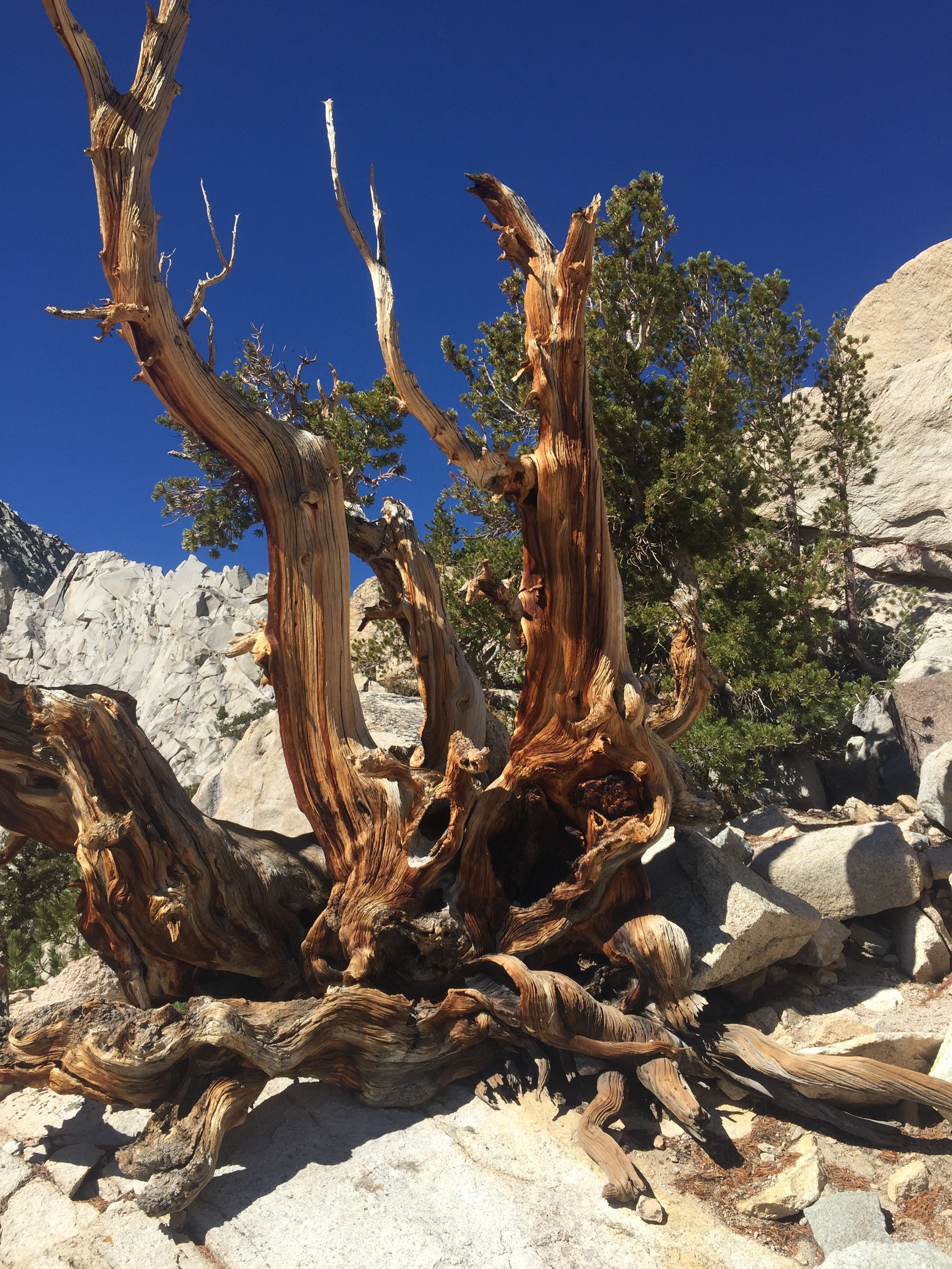
Ancient Foxtail pine on the approach to Kearsarge Pass from the east
While we were in town, we got updates on a few fellow SOBOs. We heard from Pitbull that he had reached Kennedy Meadows South (KMS) on target, and before the snowstorm. He gave us some intel on water sources through the potentially dry stretch of trail between Mt. Whitney and KMS. We also learned that Stringbean had self-evacuated from the Emigrant Wilderness on the same night that he had made his call of distress, and is no longer hiking the trail. He describes that harrowing experience on his blog, underscoring the potential consequences of being in the high country late in the season with insufficient clothing, gear, and/or food. We were relieved to hear that he is alive and well, and do hope he will return to see these beautiful mountains some time in the future. Not far along the trail to Kearsarge Pass, we passed Buena Vista sitting on a rock. There is a short stretch there with good cell service (none at the trailhead), and he was catching up on a few calls. We took a cue from him and sent a few last-minute emails ourselves. We all finished up about the same time and continued hiking up the trail together. Chatting with him, we found that we shared similar motivations for thru-hiking the PCT, and had overlapping philosophies on how best to enjoy the journey. He told us that in Oregon, while he was feeling bound by the daily mileage that is more or less required if you want to complete the trail in a single season, he started asking every hiker he passed to complete the analogy: "backpacking is to thru-hiking as __ is to __." His favorite reply was: "as enjoying a single bite of delicious pie is to entering a pie-eating contest." We completely concur. Although we have enjoyed this journey immensely, intend to complete our thru-hike at the Mexican border this fall, and know that it is an experience we will cherish for the rest of our lives, we are very much looking forward to "regular" backpacking trips. Imagine that each day you could do whatever you happen to feel like, walk wherever you please and however many miles you want, and not worry about whether you'll make it to the next resupply on time, or over Forester Pass before the first big snow. Buena Vista also told us they'd met Cookie sometime after we left them at Mather Pass, and hiked with her for a while. They had enjoyed her company (as had we), heard all about us (hopefully only the good things), and appreciated the "trickle-down" knowledge about various tree species that she said she'd picked up during the days we spent together. She is currently hiking with a JMTer named Hayes, who she'll probably stick with through the Mt. Whitney summit, still on schedule to arrive at KMS as previously planned. That would put her there 1-2 days ahead of us, but hopefully we will cross paths again somewhere down the trail. Nearing Kearsarge Pass we caught up with Buena Vista's wife Sally and her friend Sarah, who had gone ahead when he stopped for cell service down below. It turns out that their other friend Rob had left the trail at Independence due to a family emergency. The remaining threesome is still on the leisurely schedule of JMTers (vs thru-hikers), and intend to summit Mt. Whitney the day after us. Buena Vista plans to go all the way down to Whitney Portal to see the girls off before returning back over the shoulder of Mt. Whitney to continue his solo PCT hike, and will probably be a few days behind us by then. He feels like a kindred spirit, so we are hoping that the mysterious ways of the trail will bring us together again somewhere in southern CA.

Kearsarge Lakes nestled against the Kearsarge Pinnacles, with Bullfrog Lake in the distance
Delicious fresh lunch!
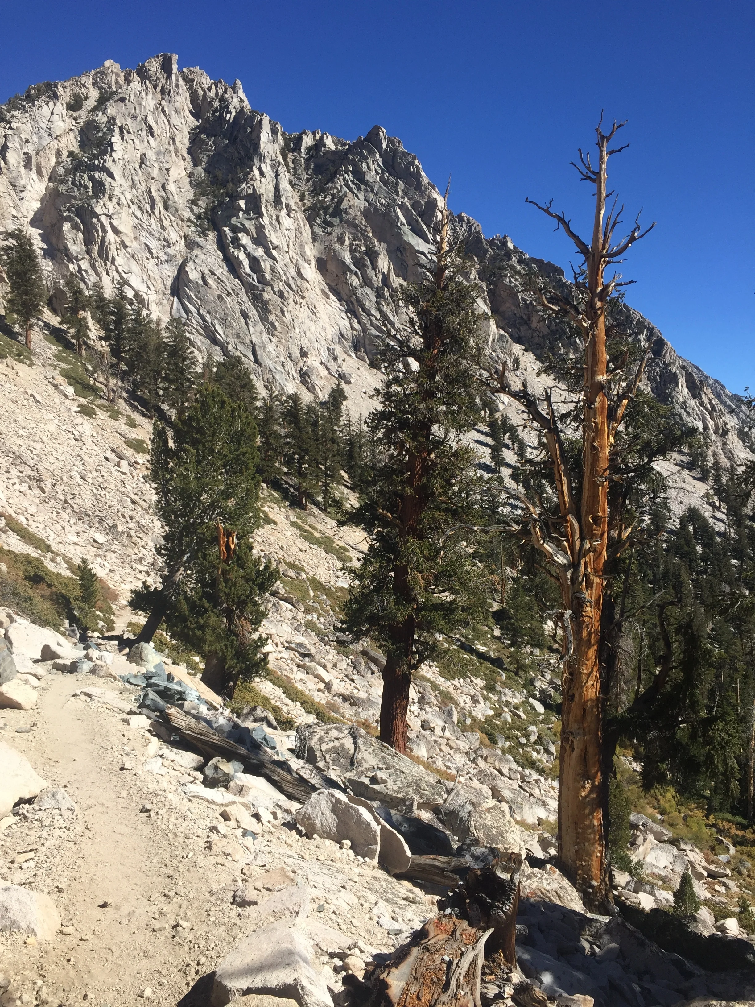
Despite the chill in the air, the weather as we returned to the PCT via Kearsarge Pass on Day 92 was downright pleasant compared to our previous few days in the mountains. A brisk wind picked up as soon as we said goodbye to Buena Vista and dropped over the pass so we each added a layer, but the sky remained clear and it was hard to have any serious complaints. We'd taken the "upper" trail on the way out, so for a change we followed the parallel "lower" trail back to the PCT. This route took us much closer to the deep green Kearsarge Lakes nestled against the base of the craggy Kearsarge Pinnacles, and right along the shore of intensely blue Bullfrog Lake with its infinity-pool far shore. We stopped at the latter to enjoy a luxury trail lunch of sunflower-wheat bread, avocados, star crimson pears, and a wheel of soft Chimney Rock cheese from the Cowgirl Creamery in Pt. Reyes near our home (all thanks to Cynthia, of course). Foxtail pines are the predominant tree species all the way from the Onion Valley trailhead back to the PCT, and there is dramatic variation in their size, shape, and degree of wild contortion based on their elevation and exposure. Since we practically ran past them on the way out due to the cold wind and blowing snow, it was a treat to stop and gawk at so many beautiful specimens of this relatively rare tree today as we returned to the PCT. From the high elevations along the Kearsarge Pass trail, we made a steep descent to Bubbs Creek and Vidette Meadow and the Foxtail forest transitioned to one primarily consisting of giant Lodgepole pines at this "low" elevation nearing 9000'. We had great views of the opposite side of Kearsarge Pinnacles as we followed the Bubbs Creek drainage, and couldn't get enough of that crazy blocky rock against a deep blue Sierra sky. It looked like a wild sideways game of Jenga played by giants using pieces of white granite. There were a handful of casual backpackers in this short stretch, some headed north to Rae Lakes Basin and others headed out to Onion Valley, the last people we'd see until tomorrow.
Kearsarge Pinnacles as we descend to Vidette Meadow, with plenty of Foxtail pines
The approach to Forester Pass along the base of Center Peak
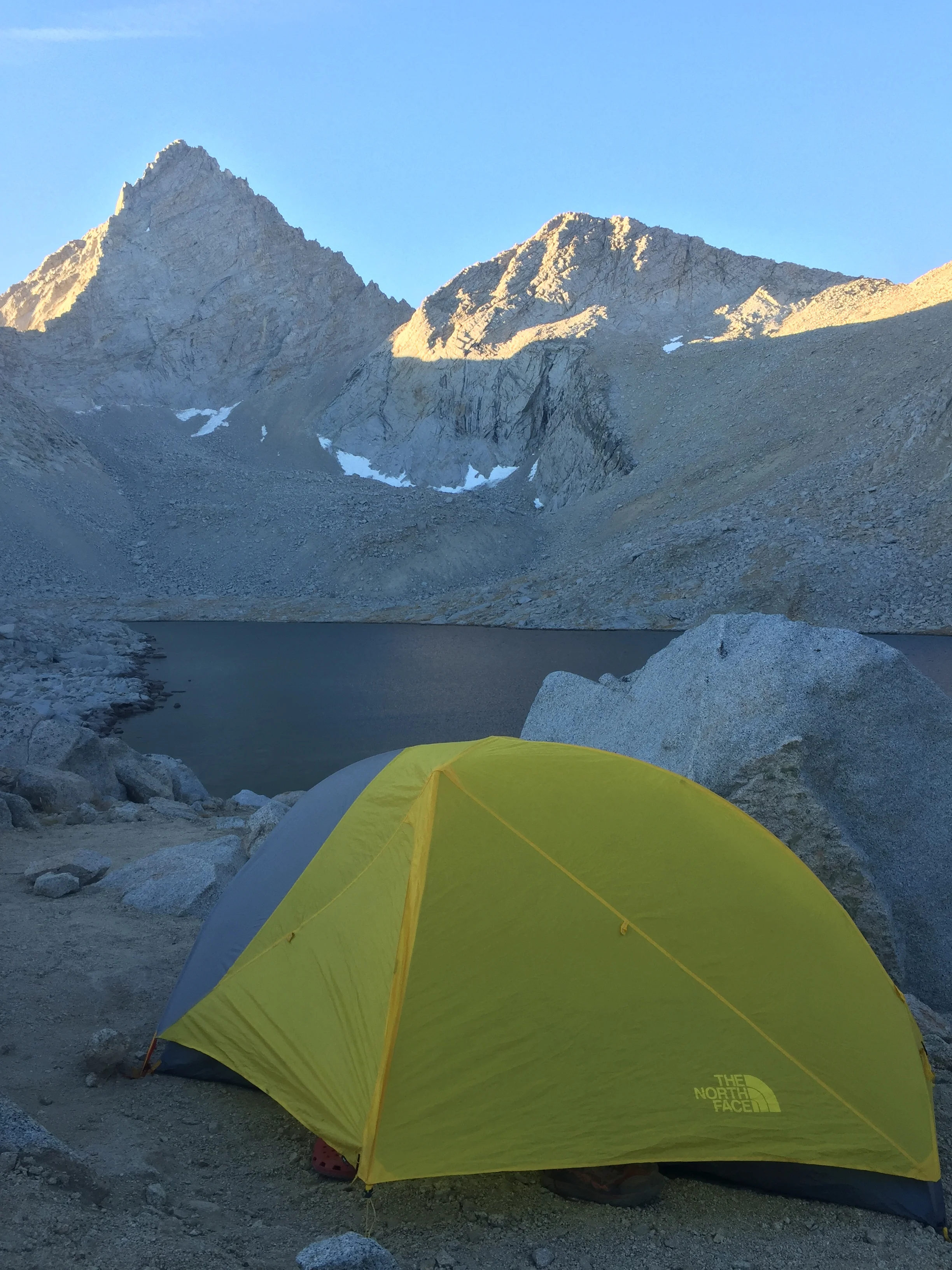
Junction Peak, the last lake before Forester Pass, and a very cold night
We decided to complete most of the elevation gain to Forester Pass today, saving only the final 1000' or so for the next morning. It was a steady climb but pleasant as we left Kearsarge Pinnacles behind to make our way towards the squared-off white granite summit of Center Peak. We walked through high meadows of dry grasses and yellowing willows, crossing several dry streambeds and a few small streams. Although it had been sunny all day, many of these streams still held ice and the late afternoon wind carried quite a chill. As we passed to the west side of Center Peak we found ourselves above treeline, with basins and shelves of variably colored granite stretching out all around us. With the high ridges to our west, we lost our direct sunlight and the temperature dropped even further. We followed the rocky trail from one shelf to the next, passing several tarns and lakes interconnected by streams of surprising size and flow given the lack of any significant snowpack above. There were a few stands of Whitebark pine and a small meadow or two hidden in protected basins, and we recognized the campsite we had used on our previous JMT hike. It was a fairly appealing spot, nestled between dwarfed pines and a wall of stacked rock and across a dry meadow from a running stream, and there was nobody else in sight. Although we were tempted, we continued on to the uppermost lake before the pass where we found a small flat spot of decomposed granite tucked into the talus field near the outlet. It was dusk by the time we arrived, and already below freezing. We hurried to set up the tent with nearly-numb fingers, and were grateful for our new gloves once that task was complete. We watched a sliver of a moon cross the small notch near Junction Peak across the lake, then disappear below the ridgeline, and the stars were incredible while I finished cooking dinner. The wind had died down and the air was still but it was far too cold to sit outside so we retired into the tent as soon as we could. The gravity-feed water filtration system would not work due to water freezing immediately once it hit the line, so we squeezed 4L of water by hand. As I was brushing my teeth in the tent, I dripped a little water onto my Crocs that were sitting under the vestibule. I picked up the shoe to shake it out once I was finished, and the droplets had already frozen solid. It was by far the coldest night we've had on-trail, and quite possibly the coldest non-winter night I've ever spent in the mountains. We don't carry a thermometers, but would estimate the air temperature dropped into the single digits. We kept our water reservoirs in the tent with us, and ice still formed inside all of them. To top it off, a howling wind started sometime in the middle of the night and showed no sign of stopping by the morning. I suppose when you select a campsite at 12,200' on an exposed rocky shelf in October, you'd better expect to be cold. Fortunately our sleeping bags and clothes kept us warm in the tent even with these extreme conditions. It's just too bad that we had to pack them up in the morning!

Macro making the initial descent down the south side of Forester Pass

Peaks of the Kern Divide from lower down on the descent of Forester Pass

You know it's cold when.... standing on ice over 1" thick in upper Tyndall Basin
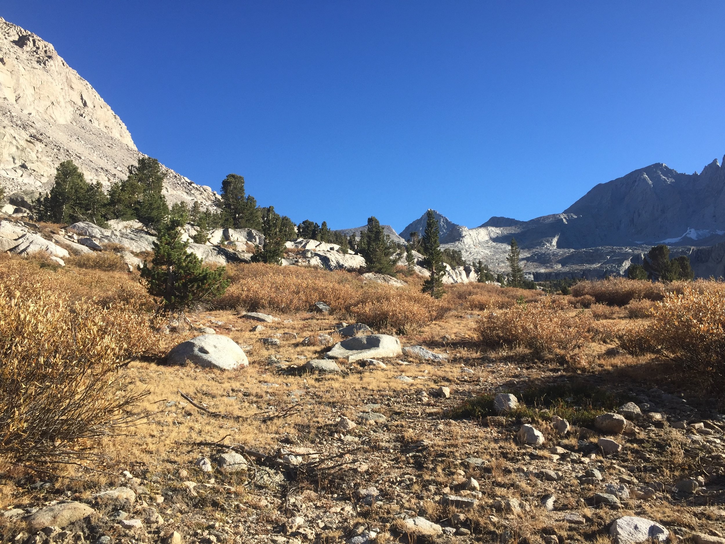
We woke on Day 93 to continued howling and frigid wind and saw that the outlet of our lake had frozen solid overnight, but at least the sky above was still clear. Forester Pass is the highest point on the entire PCT and a big landmark for SOBOs. Once you are over Forester, you are past the point of significant weather concerns and nearly assured of ultimately reaching the border. Or so the story goes. In any case, we were glad to see that we would not have to contend with any type of precipitation over the pass. It took a while to break camp in the bitter cold, but we managed to hit the trail around 8am (very late by thru-hiker standards, even ones who are leisuring through the Sierra) wearing every layer we had except our heavy down jackets. Once again, we were both grateful for the new gloves we picked up in Bishop. The trail switchbacks from the lake up to the pass, and it was a straightforward walk on this cold and sunny morning. We passed small patches of fresh snow in the shade of talus, likely from the storm of a few days ago. The views were outstanding and even though we stopped for several pictures we were at the pass within an hour. Forester Pass marks the boundary between Kings Canyon and Sequoia National Parks, and is the last pass on the JMT/PCT before Mt. Whitney. We stopped at the sign to peer through the notch in the rock down the infamous chute and to the lakes far below. For NOBOs, who must cross Forester in early season before the snow has melted, the small length of trail that crosses this steep narrow chute is often considered the technical crux of the entire Sierra Nevada section (rivaling the Bear Creek ford). For us, it was an easy walk down well-constructed if rocky switchbacks to the upper reaches of Tyndall Basin where the streams and periphery of the lakes were still frozen but in the bright sun it almost felt like a summer day. We had left the wind on the north side of the pass and despite the icy surroundings we started removing layers. The warm sun was so welcome after the conditions of last night and earlier this morning that we took an uncharacteristic mid-morning break, basking on a flat granite boulder like a pair of lizards.

Macro enjoying the warm sun at the base of Forester
Just as we were getting up to leave, a hiker came down from the pass who looked suspiciously like a thru-hiker but was unfamiliar to us. Sure enough, it was a SOBO we hadn't yet met. He started a bit after us and has recently been picking up his mileage. From him we learned that Happy Feet, who we haven't seen since Mazama Village (though we heard was only a day behind us at Castella), is just behind us and likely to pass us today. Delta was also at VVR with them, but his girlfriend has joined him for the JMT and they are currently hiking "only" 20-mile days so he's probably still a ways behind us. We walked together a while and got to talking with this new SOBO. He had been pushing 27-29 mile days since the northern border of Yosemite, very high mileage for the Sierra Nevada even by thru-hiker standards. He said it's a pretty enough section but he's looking forward to being done with it due to its difficulty. He didn't know the names of any places he's camped, just their mileage from the previous night. To keep up with the guys he's been hiking with, he has to hit the trail by 5am and hike until dark each day. We asked if he was planning to summit Mt. Whitney and he said no, he's just too tired and would rather have warm food at KMS a day earlier. We learned that he is stoveless but resupplied both at VVR and again at Independence, just one day ago, so even accounting for a Whitney summit he would be only 5 days at most between warm meals. It reminded us of the NOBO we met at Goat Rocks in WA who didn't go across the Old Snowy knife-edge (considered by some to be the highlight of the entire PCT) because it was ½ mile longer than the lower route, and he just wanted to get to the border sooner. While chatting with Buena Vista for a few miles made us feel like kindred spirits, walking with this new SOBO over a similar distance made us realize that we had almost nothing in common other than the title "thru-hiker." He was a nice enough guy nonetheless, and we wished him a good hike as we parted ways. HYOH.
By The Numbers: For those interested in calendar dates, we crossed Forester Pass on October 6, putting us on target to reach Kennedy Meadows South on October 10 (with allowance for a Mt. Whitney summit side trip). We've had three days of significant wintry precipitation in the Sierra (with the earliest on September 21), a handful more with short-lived blustery rain or snow, and several that were very cold. It has frozen every night since at least Sonora Pass, and the high country nights are getting progressively colder as the year goes on.
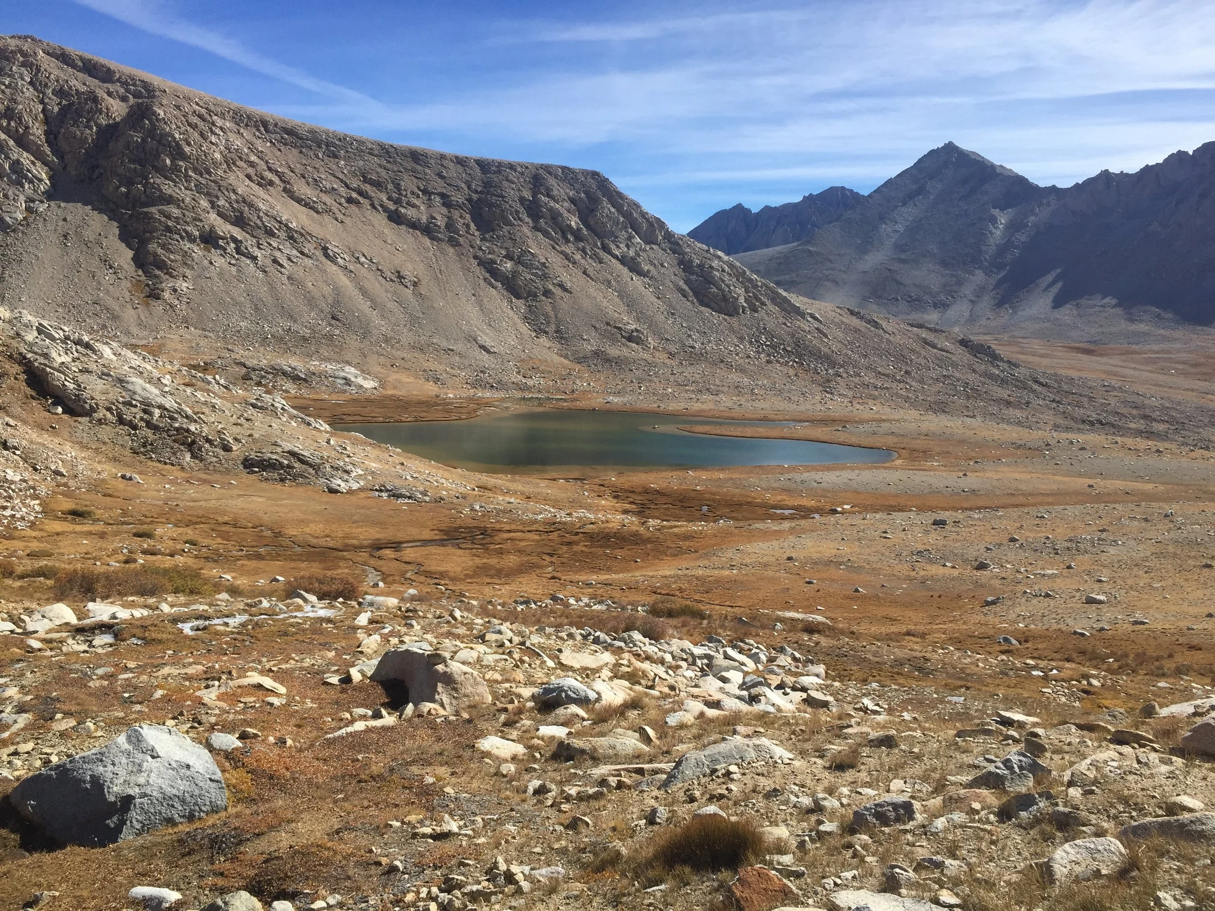
Upper Tyndall Basin
While we were still above treeline in upper Tyndall Basin we were surprised to come across a trail runner, heading north towards Forester Pass before 10:30am. She was fit, tan, and moving well but other than shorts and a short-sleeved shirt she only had a small running vest with bulging pockets. She looked vaguely familiar but passed before we had a chance to say more than a quick hello. The only trailheads to the south are Shepherd Pass, a long and poorly maintained route that is rarely used but does join the PCT near Tyndall Creek, and the Whitney Trail that is not only a long way from here but also includes an enormous climb over the shoulder of Mt. Whitney before dropping down to the PCT. Any west-side approach would be at least 50-60 miles, if not longer. We assumed she must have a base camp somewhere nearby and be out for a daytime run. We didn't think much more about it until late in the afternoon, when we came across a 20-something guy hiking the JMT with his dad. They had camped just below treeline in Tyndall Basin last night and were surprised when a girl with no backpack came running up the trail as they were cooking dinner. Her name was Jenn Shelton, and she had run from Whitney Portal planning to go over Forester and Kearsarge Passes to exit via the Onion Valley trailhead. Given the time of day, the already cold temperature, and her limited gear, they convinced her not to continue over Forester that night. They were camping near a couple from Australia also hiking the JMT, and that pair shared one sleeping bag for the night to give Jenn their second one. Between the 4 hikers, they came up with enough spare food to feed her both dinner and breakfast, and then sent her on her way towards Forester Pass this morning as she said her friends had been instructed to call SAR if she hadn't returned home by this evening. Hearing these details, it all started to make sense, as Jenn Shelton is an accomplished trail and ultra-runner who has run the entire JMT multiple times in pursuit of an FKT. We have seen her interviewed in various films and other outlets, which is why she seemed so familiar. And nobody else in their right mind would run over Mt. Whitney to access the PCT/JMT. Hearing the whole story solved our little morning mystery, and it also reinforced what we already knew, which is that hikers are just good people, whether they are thru-hikers, JMTers, or casual backpackers.

Snag along Tyndall Creek
Near the Tyndall Creek crossing (another rock hop) we ran into a SeKi NPS ranger, who chatted us up a bit then asked for the last names on our permits. Although he didn't ask us to produce them, this is the closest we've come to having our permits checked since we started hiking 3 months ago. He asked if we'd seen a solo Korean hiker named Mr. Lee in the past day or so. While we don't talk to everyone we pass and rarely ask names, there aren't that many people on the trail these days so we tend to notice them all. We told him the only person of Asian extraction we'd passed was hiking with a large group, and didn't seem to fit the description. He didn't offer why they were looking for the guy, but it's always a worry when there's a ranger asking after you, so we hope Mr. Lee is well, wherever he is. Before parting ways, we asked about the weather forecast and he said it called for clear weather with a warming trend over the next several days. He didn't know the conditions on Whitney as he hasn't been up recently, but noted that the last storm brought no significant accumulation and he suspected that the top of Whitney would be similar to whatever we found coming over Forester. Based on this fairly reliable source, it sounded like conditions and weather would be perfect for a Mt. Whitney summit tomorrow.
Lodgepole pines near treeline in Tyndall Basin
Peaks of the Great Western Divide across the stark landscape above Bighorn Plateau

Mt. Whitney (center, flat top) from the Bighorn Plateau

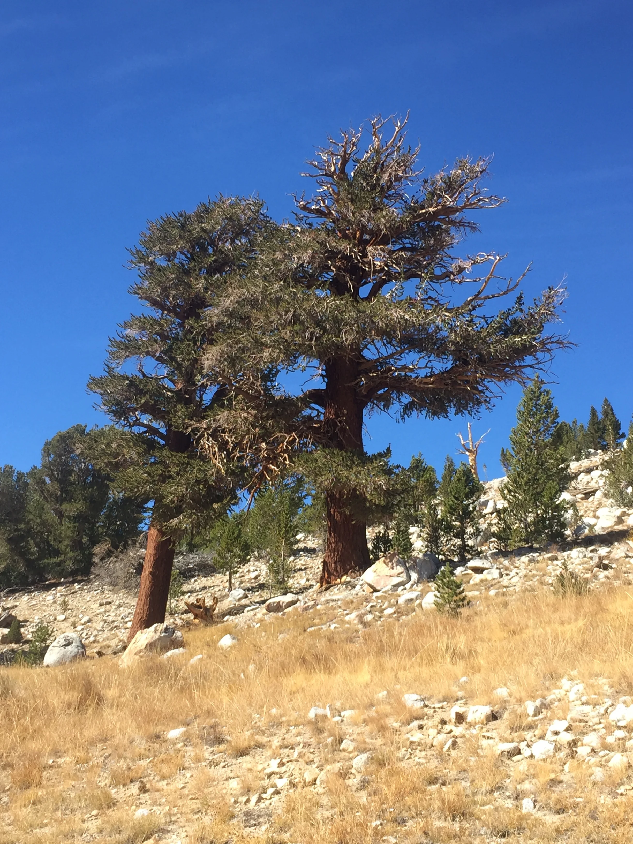
Tawny Point and a slope of Foxtail pines
Once we dropped below treeline along Tyndall Creek, we found ourselves in an open forest of Lodgepole pines contorted by the harsh conditions in this high exposed basin. The many snags that stood among the living trees popped with a rich golden color against the deep blue sky, and many of the living trees had a spiral of exposed wood to match where their bark had been stripped away at some time in their long past. As we descended a bit further we started to see a smattering of similarly dramatic Foxtail pines, and for the rest of the day these would be the only two conifers along the trail. The afternoon miles took us across "easy" terrain with dramatic vistas and the stark yet stunning scenery that to me is classic southern Sierra high country. We climbed a rocky slope populated by giant Foxtail pines towards Tawny Point, a treeless mound of yellow-tan scree on the edge of high, flat, and empty Bighorn Plateau. The plateau itself is largely treeless and consists entirely of decomposed granite with small mounds of yellow grass, though a few seriously contorted Foxtails grow around its edges. A wide but shallow blue tarn sits right in the middle of the plateau, looking just like a desert oasis. All along this stretch the long string of rugged peaks comprising the Great Western Divide creates a stunning backdrop to the west, while the peaks of the Kern Divide near Forester are still visible to the north. We got our first glimpse of Mt. Whitney here too, though from this angle the view is of its raked-angle flat top, and it is hard to believe that this unimpressive peak is the highest in the lower 48 states. While we always love the stark drama of this region, in peak backpacking season it can be blazing hot with nothing to mitigate the high-elevation Sierra sunshine and we often find ourselves rushing through to avoid heatstroke. It was a nice change to be able to lollygag through these long and exposed but also stunning sections on a mild day in early October with reasonable temperatures and a light breeze, enjoying both the long views and the smaller details.

Bighorn Plateau with the Great Western Divide beyond

So many Foxtail pines
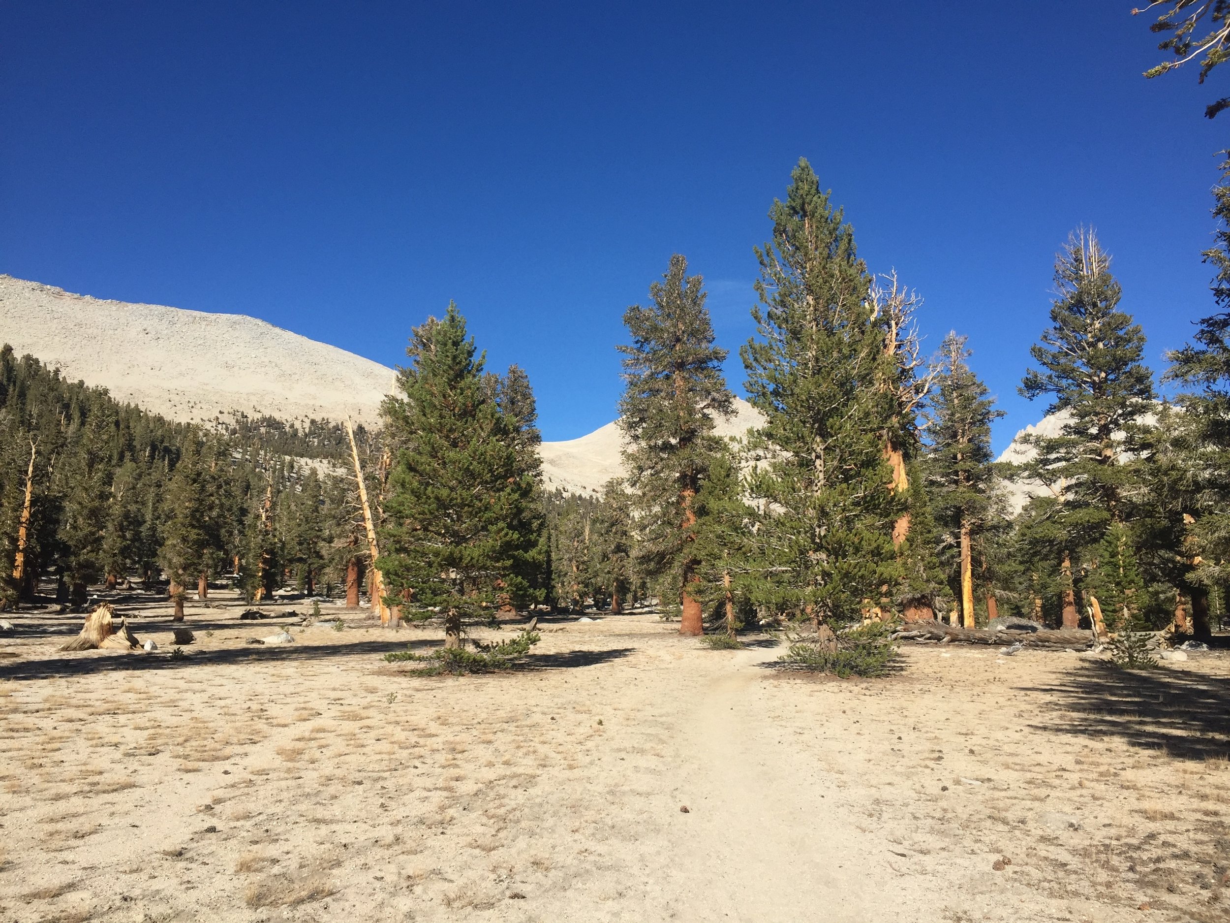
High elevation Foxtail pine forest near Crabtree ranger station, Sequoia NP

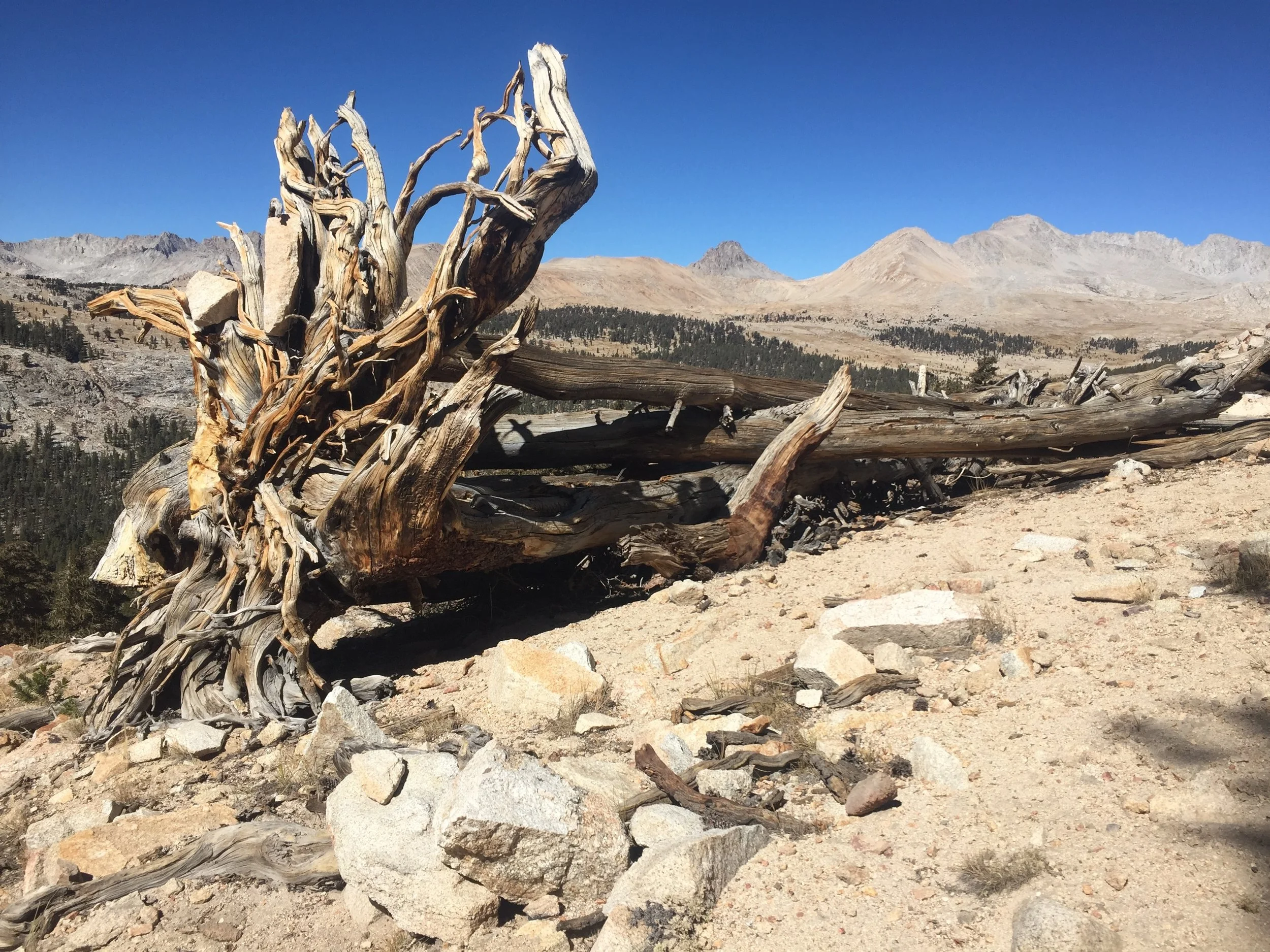
Golden hour light on exposed Foxtail wood
Beyond Bighorn Plateau, the trail passes through a few miles of open Foxtail pine forest, with little to no undergrowth since the soil is so poor. It is striking to see such enormous trees growing right from decomposed granite, with a ring of cones and needles underneath each forming the only organic matter. With the trees spaced so far apart there is limited shade so it is another region that can get quite hot in the summer. Once again, we found it remarkably pleasant today. By mid-afternoon and for the first time in many days, we had removed all of our extra layers. Who would have guessed that after our coldest night on-trail, we would go right into our warmest day in weeks? Knowing that we are nearing the end of the range where we will see Foxtail pines, we took time to appreciate some of the most beautiful specimens, and took plenty of pictures in the golden afternoon light of early fall. Soon enough, we had reached the junction with the Whitney Trail. We turned east away from the PCT, headed for the Crabtree ranger station. From there, we will find a base camp for tonight suited for tomorrow's dayhike to the summit. Once we continue south on the PCT, we will quickly exit the range of these special pines and soon after that be out of the Sierra Nevada altogether. It is hard to believe that we have already walked nearly through the entire mountain range. After tomorrow, the trail will be a blank slate to us as we have never set foot on the PCT south of Mt. Whitney excepting a very small stretch in eastern San Diego county. While we are sad to leave this most familiar stretch of mountains that we love, we are also excited to discover what the trail holds in store for us in the weeks ahead.
- Huckleberry